Wednesday 29 May 2013

Day 39 : The wind

29th May 2013
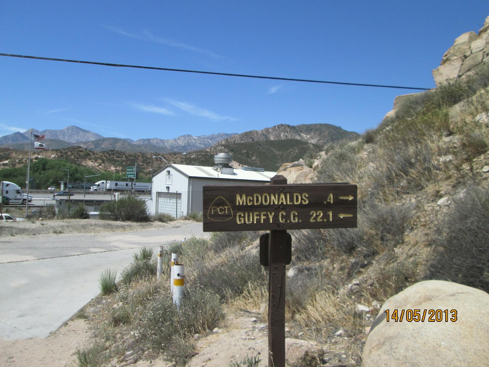
Mile 542 to mile 558 : Tylerhorse Canyon to Willow Springs Rd
Mileage : 16

In my last post I said that that day was the most difficult on the trail so far. I was very wrong. Today was, by far, the most difficult thus far. It was the first and only day so far that I have really not enjoyed myself and really questioned what i was doing out there. There was one day at Rodriguez Fire Tank during the first week near mile 65 that I previously had thought was difficult, but it doesn't compare at all. It doesn't even come close. Today was just horrific. In fact the only good thing about today was that it ended.

With my bandanna covering my face I slept better than I thought i would, but still everything was covered with sand and grit when i woke. I had hoped that the wind would die down overnight but it became clear as i started the day that that was not going to happen, it actually felt stronger if anything. Worse than the strength of the wind was that fact that it wasn't constant. The evening before the trail led almost directly into the wind as we climbed out of the desert, so it was 'relatively' easy to just lean into it and keep on slogging away at the trail. By contrast, today, the trail was back to its usual winding self as it proceeded northwest through the hills. Although the main direction of the wind was unchanged, the turbulence caused by the hills meant the wind was constantly changing, and the winding nature of the trail meant the wind seamed to be buffeting me from all directions at once. And again there was no respite, the only way to get it to stop was to finish the hike and get to the road from which we'd be hitching into Tehachapi. It took forever. 16 miles by now is not a long way, even with climbs, but today was different. It took forever. It took so much effort mentally and physically to walk in a straight line on the one foot wide trail i was exhausted after only a couple of hours, it took forever. To compound the difficulty of the weather, I was additionally hindered by the fact that the tip of my remaining hiking broke off at some point and was sliding around on the rocks and making me nervous about putting real weight on it rendering it close to useless. I have been less than impressed by my Leki poles, and would not buy them again given the chance, but i am stuck with them for the time being. On top of everything I have described above, the straw that finally broke this camel's proverbial back was my achilles, which flared up again in style. I had thought it was getting progressively better, but after the climb today it really started to hurt again. After stopping to attempt to quell the pain with many milligrams of Vitamin I, I struggled on. I was not a happy bunny.

Usually I have nothing but admiration for the PCTA and the trail, but today there were many expletives used to describe whoever routed the trail in this section. Instead of using the relative shelter of the valley that I could see from the heady heights of the trail, the route in fact lead just below the windward side of the crest of hills we were traversing. It was less than ideal. Retrospectively, i know that in this section there is a lot a private land around which the trail has to skirt, and that the wind was uncommonly strong, but it didn't stop me venting.

My extremely bad mood persisted for hours until the road came into view. As the road appeared in front of me so did a hiker who informed me that the trail was closed for the next couple of minutes as a fellow hiker was taking a loo break in sight of, if not on, the trail. I sensed a perfect opportunity to vent my feelings and let rip. I felt so much better for it, and to be honest, even retrospectively, the abuse i hurled was justified, although I could perhaps have gone about it a little more diplomatically. The trail for 4000 + kms is one foot wide, meaning most, if not all, of the land through which we are hiking is not the trail and even in the desert sections there are, and indeed in this specific instance there were, innumerable bushes behind which a hiker could have gone about the necessary in relative privacy. In my mind there is therefore, little excuse for being so lazy as to go to the toilet within sight of the trail requiring a fellow hiker to stop all other trail traffic. Having less than politely informed (although i promise there there were no expletives used, it was more that there was a lot of sarcasm and withering looks) the traffic warden hiker of the aforementioned information, and feeling much better for it, i proceeded past him uncaring of the toileting hikers privacy who was indeed squatting one foot off the trail, and arrived at the road a couple minutes later, glad that the day's hiking was over.

My mood much improved, even more so after getting rides almost immediately from Keith and then Melissa, I met back up with team PRT doing what team PRT does best, taking on calories and not hiking, and I added my considerable expertise and talents in these matters to the group's, slowly calming down after a very long and difficult day.
Mr Green struggling uphill into the wind

There is a reason there are so many wind turbines!

Day 38 : The Mojave Desert

28th May 2013
Mile 518 to mile 542 : Hikertown to Tylerhorse Canyon
Mileage : 24

Today was difficult, there is no other way to describe it. It started pretty weirdly when the owner of Hikertown Richard Skaggs invited me in for breakfast after learning I was English. Richard Skaggs is a self confessed anglophile and collector of vintage Rolls Royce cars. As per the attached photo, there was even one in the hostel grounds that was once owned by princess Margaret, bizarre! After the first decent cup of tea that I've had so far on the trail it was time to start hiking. The weather had so far been on our side up until today, and for the beginning of today it seemed like our luck was going to continue as it wasn't set to be too hot. But the compromise on temperature was that we would have to put up with wind. And there was a lot of it. Although it was coolish it was still a desert, but we managed the first 18 miles done by 4pm. For the majority of those first 18 miles we followed the Los Angeles Aqueduct that runs along the valley floor. Just after Hikertown the aqueduct is open and we got to hike along it for a mile or so, after that it is covered over with gigantic concrete slabs that form a rough road upon which we were walking. Unfortunately for hikers there is no access to the aqueduct, so water must be carried for the 18 miles even though at times we could hear the water rushing below our feet as we walked. It as not easy. One additional difficulty of this section was that concrete, and the track that ran next to it, is hard on the feet. The heat and pounding on the hard surface, along with my new footwear conspired to give me new blisters, one of which is just between my right big toe and the ball of my foot, meaning it hurts everytime i step or try and flex my big toe, less than ideal. After that though the day totally changed. From the valley floor we had to climb 2000ft up to Tylerhorse Canyon, not usually a difficult ask now even at the end of the day. But then there was the wind. I set of in front of the others as I was feeling strong but soon slowed as it became clear the last 6 miles were going to be very difficult indeed. The wind was coming almost head on and was strong, so strong in fact that i couldn't stand up straight in it, and there was no escaping it. This section of the Mojave is renowned for its wind, and its wind turbines, and it did not disappoint. I read later that it was gusting 50-60 mph and could well believe. It was definitely the most difficult 3 hours of the entire trail so far. Completely knackered I arrived in the failing light at Tylerhorse Canyon hoping that the canyon would provide some respite from the wind, but I was not so fortunate. Everything about the evening routine was made more difficult knowing that no item of equipment or clothing could be left unattended lest it blow away. Usually the first thing i do when arriving at camp is set my stove up to boil water for dinner and then start other chores. That evening though this wasn't remotely possible, my alcohol stove in had to be as close to me as possible in order to shelter it from the wind, and had to be watched at all time to make sure it didn't blow away as it could have easily set the brush alight had it blown away. All chores finally complete i got in my sleeping bag and tried to sleep. Even sleep, which usually comes easily after a long hiking day, was difficult. Not only was the howl of the wind almost too loud to allow me to sleep , but each gust blew fine particles of grit and sand into the small aperture in my sleeping bag that I usually breathe through. Eventually I worked out that if i tied my bandanna totally across my nose, mouth and eyes I could breathe through it and avoid the wind and grit. Sleep was pretty instantaneous after that.
Accomodation at HikerTown

The long and not so winding road through the Mojave


A Rolls Royce once owned by Princess Margaret

Day 37 : Hikertown

27th May 2013
Mile 496 to mile 517 : Cougar junction to Hikertown
Mileage : 21

So we all made it through the night unmolested by mountain lions, and got moving early. A few miles later we hit the 500 mile marker and celebrated! Woooo! Quite an accomplishment! Many repeats of the proclaimers later we set if again on our way to Hikertown, the last stop before the Majove. From BigBear the trail tracks west avoiding the Majove desert which, for the most part, we have been able to see from the trail as we inched our way along it. Now though the trail turns north and across the desert. The crossing is a 24 mile dry stretch across the flat, hot, dry, dusty and windy desert floor. Fun times. For our crossing it will be sufficiently cool that we can cross it in the day. The reason it is so cool is the wind. Gusts up to 60mph are forecast for the next 2 days. Even without the sun it is going to be difficult, difficult, lemon difficult.

Hiking aside today we decided on a hiking challenge in true TopGear style. The group decided that at Tehachapi, we each have to choose a secret santa 'gift' for another fellow hiker to take with them all the way through he Sierras to Lake Tahoe. A present must weigh no more than 1lb, must be large and cumbersome, must be blogable, and must be carried at all times on the outside of one's rucksack. I have 2 days to think of a suitable present. Any suggestions?

Day 36 : Section E

26th May 2013
Mile 478 to mile 496 : Green Valley to Cougar Crossing
Mileage : 18

We managed to escape the vortex surrounding he Andersons relatively early today, and set about covering the18 miles set for the day. In response to a  blog comment about mileage per day i thought id give a quick explanation.

Mileage in these first 6 sections is mostly governed by water, or the arrival into a trail town etc. Today we are doing 18 miles.as this is where there is a guaranteed water source, and given he next day will be a dry 21 miles it seems sensible. It is always preferable to camp by water as usually it means washing and cleaning is possible. If the weather were different, it would be not only the distance that would feature when determining day distances, but also time of day and terrain. Bu thankfully for the moment it is cool enough that we don't have to think about that just yet.

As we finished our day we ended up as planned at the water tank. As we sat there eating a pickup truck pulled up next to us and started asking us about mountain lions. Oh dear. The only thing i knew up to this point is that i am an unlikely target given my size and gender. Cheddar and Roo have already had an encounter and given their reaction I'm not sure i want to bump into one. Joggers one trail runners are, more often than not, the victims of mountain lion attacks due to the fact that the running triggers an instinctive chase response in the animal. Thankfully hikers, with slow speeds and large packs are less of a target. It turns out though that he saddle where we intended to camp was q heavily used mountain lion junction. The guy in the truck was checking on his camera traps and had seen at 2 already this year. Lets hope they take the night off tonight. An encounter in the middle of he night answering the call of nature would be less than ideal.

Day 35 : The Andersons

25th May 2013
No miles
Mileage : 0
Today was a weird day. We intended to stay up until the afternoon and then hiking out in the evening, but invariably we stayed  later, until the next morning in fact. But we should have left earlier. Today was the first day that i felt bored. Zero days are really only zero days in terms if hiking, but usually there are a lo of chores to do. But not this time. Given the zero day at the Saufley's all my chores were done, so there was nothing to do but do nothing, and that felt very weird indeed. It also felt weird because it is clear that the herd is slowly catching us up. Seeing all the new faces after weeks of seeing the same few felt odd, uncomfortable even. When hiking you live in a bubble of people just ahead or behind you, and the rest of the hiking pack (this year over 900) don't really exist. Although im sure my Hiker group are no different to any other, seeing so many groups together seemed to intrude on my 'wilderness experience'. I wasn't the only to feel this and we all agreed to get out early the next day.
I should point out however, that although the  place felt weird, the Andersons are incredible. Although the house is small the property is large enough for over a hundred hikers. Every morning the cook pancakes for everyone, and every evening they cook taco salad for everyone, what they do is amazing!
An as yet unidentified hiker, me and Terry Anderson

Life at Casa De Luna is difficult

Saturday 25 May 2013

Day 34 : 24 miles

24th May 2013
Mile 454 to mile 478 : The Saufleys to the Andersons
Mileage : 24

Today was good, my body felt good after the rest the day before, my achilles felt way better with no strapping even given a relatively steep 1700 foot club out of Agua Dulce. The other day i felt good was the goal : The Andersons. Along with the Saufleys, the Andersons are among the most famous of the trail  angels. Hikers are encouraged to get their chores done at the Saufley's, and chill out at the Andersons, and so we planned to do exactly that. There are 24 miles between the two angels, and they went by quickly. Before i knew it we were standing on the side if the road trying to hitch to the Andersons who live a few miles off the trail. As luck would have it the first truck to come.past stopped and we piled in. The ride this time was courtesy of Tommy and his dog Moonshine who one exactly where we wanted to go and dropped us off a few minutes later. The Andersons is commonly known as Hippy DayCare and also as Casa de Luna, for reasons that will become clear later. All hikers are greeted with a slow clap from all the other hikers, and with a hug for Terry, the angel who has been hosting hikers.here for over 14 years. Unfortunately we arrived too late tor the famous Taco Salad dinner that is laid on every night for the hikers, but we plan to nero here, eat dinner in the evening, and get some evening miles done in order to set up fo a night crossing of the Mojave in q couple nights time.

Day 33 : Zero at the Saufley's

23rd May 2013
No miles
Mileage : 0

Today was a full zero, but there was plenty to do nevertheless. I planned on taking advantage.of the trip to the ish local REI camping shop for some new equipment. Three items of my kit need renewing in some way or another. The firs is my broken trekking pole. I broke it just before Deep Creek and have finally gotten hold of the shop who sold them to me and who agreed to send me a replacement to Kennedy Meadows so hopefully I'll be back to two for the Sierras. The second is my footwear. Clearly my running shoes are just not adequate for the trail so I've replaced them with trail runners, i hope the new shoes work out better. The third is my sleeping bag. As previously mentioned my current bag is not good enough so I've decided to get a new one and have it mailed to me at Tehachapi.

Chores complete the rest of the day was spent updating my blog and generally relaxing. While i was sitting around today i took the opportunity to try and break in my new shoes, which are great so far. Almost instantly i could feel my Achilles was hurting less, so I'm convinced the route of my pain has been my shoes rather than an injury, acute or chronic.

Wednesday 22 May 2013

Day 32 : The Vasquez rocks, the end of Section D, & the SAUFLEYS!

21st May 2013
Mile 444 to mile 454 : KOA camp to The Saufleys
Mileage : 10

Today I saw the Vasquez Rocks, finished Section D of the PCT, and arrived the Saufley's! What a day. I woke up with a start as I rolled off the picnic table I had been sleeping on. Picnic tables are always preferable to the ground, so whenever I'm at an actual campground I sleep on them, but doing so does come with the occasional hazard of a rude awakening. Formal campgrounds come with amenities, but usually you pay the price somewhere, and last night was no exception. It would appear my curse (never being out of hearing range of a small screaming child) is alive and well, and that coupled with the campground floodlights, the busy road and my inability to stay in bed resulted in a rather restless night. None of that mattered though as the hiking was only 10 miles today. 10 miles in the morning goes quickly on the trail, and before i knew it we were passing under Hwy 14 and entering the Vasquez Rocks desert park! The Vasquez Rocks are an incredible rock formation created by the erosion of an uplift of the San Andreas fault tens of millions of years ago and have been a filming location pretty much since the birth of film. And I was there!

The Vasquez Rocks are located on the outskirts of Agua Dulce, which marks the end of section, a small community located halfway between the Mojave and the LA urban sprawl and is home to perhaps the most famous of all trail angels : The Saufleys. I overhead Donna Saufley explaining to hiker that this is their 17 year of hosting hikers like myself, and everything runs like a well oiled machine. There are loaner clothes to wear while yours get washed. There is a planning area for working out resupply for the next sections, there are computers for those like me that need to update blogs and get back in touch with the world. There are tents and cots set up for hikers to sleep in, bikes for going into the town centre, rides organised to camping shops and much more. Tomorrow, there is even a cello concert given by Cuddles, a professional cellist who is giving concerts as a way to kick his skills ticking over. Mostly though it is good to be a bit more civilised and relax somewhere other than under a tree on the trail.
The Vasquez Rocks

The PCT emblem is everywhere!

Day 31 : 1 month in

20th May 2013
Mile 418 to mile 444 : Mill Creek Ranger Station to KOA camp
Mileage : 26

At some point during the night the wind started. It wasn't as strong as it has been on the trail, but it was sufficiently strong that I couldn't really sleep. So being ish up when dawn broke it was pretty easy to get going and get some early miles in before the heat set in. For most of the day the trail led through the burnt area left by the Station fire. The station fire, in 2009, burned a huge area of the forest around Mill Creek and left 2 firemen dead when it subsided. The fire was so strong the metal sign posts along the dirt roads had melted. As poodledog thrives in burn areas much of the trail has been rendered impassable so a good portion of the first part of the day was spent walking on dirt roads cutting back to the trail whenever possible. Today was somewhat of a milestone. One month ago exactly I started out from the Mexican border on my way to Canada, and now I am a good 400 miles closer to my goal. On the first day I couldn't do 20 miles with 5 litres, I had to stop at Hauser creek to take on another 2 before being able to get through the rest of the day, and it took me 12 hours to do the distance. Today however, I did 26 miles in 9 hours hiking throughout the heat of the day drinking only about 4 litres from start to finish. This quite literally would not have been possible a month ago. The aim of the day was to get to a Kampground Of America site which has real amenities instead of the usual make do rough camping to which i have become accustomed. To be fair I was pretty tired and probably dehydrated when I arrived, but no more so that any other day, so was pleased to have arrived safe and sound at the end of a long day and have a real shower as a reward.
The memorial to the two firemen who lost their lives in the Station  Fire

A section of burnt forest

Day 30 : The poodledog

19th May 2013
Mile 396 to mile 418 : Cooper Canyon trailcamp to Mill Creek Ranger Station
Mileage : 22

The poddledog bush took centre stage today. The poodledog bush is a poisonness flowering shrub that causes severe irritation when touched, and is one of the major hazards of this section. The seeds lay dormant in the soil until disturbed, usually by fire or something similar. It then grows and blooms before dying off when the cycle starts again. This section of the PCT has seen several large fired in recent years, some caused by nature, some by accident, and some by intent. The result is hundreds of PCT hikers pirouetting around the plant whenever it appears on the trail, and this takes time. When in the groove I can easily maintain 3mph for several hours, but in these sections that sort of speed could result in getting the invisible poisonness hairs all over me, my clothes and my rucksack. And given that it takes anywhere from 2 to 9 days for the severe blistering to kick in, and given the hairs stick to whatever they touch there is considerable scope for a trip to hospital. The plant is similar in appearance to Marijuana and according to trail myth, some idiot mistake it for such, tried to smoke it, and spent a long time in hospital with severe respiratory problems and blistered lungs. Not good. The nature of the plant also makes it difficult to remove. Burning it doesn't do good in the long term as any dormant seeds respond to the heat and it just grows back at speed, any attempt to hack it away just releases the hairs into the air where they are inhaled by the unfortunate trail worker, and the hairs can't easily be washed off so any contaminated clothes remain so, and can contaminate anything else into which they come contact. All the above means all hikers treat the plant with extreme care, and it means that in infested areas the hiking speed can be much, much lower either adding time to the day, or cutting miles. Wherever the trail is impassible, it means a road detour. Although clearly a road detour is way better than nothing at all, they are generally not fun. The surfaces of the roads, even dirt roads, are a lot harder than the trail and really hurt the feet. Being wider than the trail they are usually exposed to the sun, and take more circuitous routes than the PCT, but sometimes, like today there is no other option but to take them. I'm glad the burn area is small.
Pretty as it is, the Poodledog bush is to be avoided at all times.

Day 29 : Mt Baden Powell

18th May 2013
Mile 374 to mile 396 : Cloudy campsite to Cooper Canyon trailcamp
Mileage : 22 + 3

After a poor showing yesterday, I was determined to get some real miles in today. But the hiking gods were definitely not making it easy. I packed two stuff sacks away in my sleeping bag, and thought i'd lost them to the wind for a good 15 minutes, and also left my sun hat at the campsite, although it was less than a campsite and more of carpark at the base of the Mt Baden Powell. I realised a few hundred steep metres up the trail, Doh! The view from the summit was perhaps the best so far on the trail. 360 degrees in all directions, and even a view of Mt Harwood hiding behind the larger Mt San Antonio. Just after the summit I took my first USD (Unscheduled Scenic Detour), it took me a mile and half and couple hundred feet of descent before i realised. This warranted the 2nd Doh! of the day, ah well it was bound to happen at some point. Towards the end of the day we also had our first road detour. The detour was due to a small endangered frog that makes its home in a small canyon through which the PCT is usually routed. There is an official trail detour, but it adds an extra 15 miles so that was vetoed pretty quickly. The alternative is a 2.7 mile road walk. Roads it turns out are extremely hard on the feet. My feet are sensitive enough from the endless trail pounding without having to subject them to a road surface, but there wasn't really another option.
Team PRT in action at the top of Mt Baden Powell

Somewhere below the clouds LA is going to work
The monument to Lord Baden Powell, founder of the boyscout movement

Tuesday 21 May 2013

Day 28 : Camping in the clouds

17th May 2013
Mile 369 to mile 374 : Hwy 2 to Mt Baden Powell base
Mileage : 5

Today was a really low mileage day. We didnt get the earliest of starts, someone had bought a substantial amount of beers the evening before and they needed to be drunk. Many breakfast beers and breakfast beers later, we hitched back to the trail. The ride this time was thanks to Michelle and her son Hunter who live in Wrightwod. About 5 minutes after starting we bumped into Toots and Tears, and promptly stopped hiking. As we sat catching up with the two, the clouds rolled in, and soon we were dwn to visibility of less than 50 metres. This did not bode well for the summiting of Mt Baden Powell that we had planned to do that afternoon. Instead we decided that it would be best to summit the next morning when the weather was supposed to clear up. This meant, however, that the day's mileage total was 5, less than ideal. It also meant that these miles would have to be made up over the next few days, also less than ideal. After many hours of huddling behind an outhouse avoiding the wind and cloud/fog i headed to bed early, but not before learning from a dayhiker coming down from the mountain that the weather was fine about 200 metres up the trail and a few tens of metres farther up in altitude. Great.

Day 27: Wrightwood

X May 2013
Mile 357 to mile 369 : Gobbler's Knob to Hwy 2
Mileage : 12

It was great to wake up in a pine forest again, and for it to be cold in the morning. The aim of today was to get as quickly as possible to Hwy 2 and from there into Wrightwood. The hiking was along a ridgeline with views right down onto the San Andreas fault and Wrightwood, which lies rigt on the fault itself. The views also extended out onto the Mojave desert that we're skirting, I am not looking forward to the Mojave sections, but it looks like there'll be a full moon during the period when we'll be crossing it, so the nighthiking should be ok.The PCT actually goes past Wrightwood, but the most direct route into the town involves a very steep descent. As descents are way worse than ascents, so what PCT hkers usually do is to continue up trail to where it crosses Hwy 2 and hitch back to Wrigtwod from there. Hwy 2 is a stunning mountain top road which is closed all winter for snow reasons, but opened a few days before we got there, so we knew there would be cars going by so didnt think hitching would be too difficult. It turned out to be way better than  'not to difficult': Ginger, a fellow hiker had her mum and sister meet at the pass and they had brought the best fruit salad of all time with them. See soon to be attached photo. Also at the pass was Adam, also know as Aloha thanks to his Hawaiian shirts. Adam is supporting his wife Toots Magoots and her friend Tears for Beers as they make their way up the trail. Adam has become a defacto angel for everyone that is keeping pace with the two girlss, there is a picture of him in the BigBear post as he stayed with us in the cabin we rented.shared the cabin with us at BigBear. Toots and Tears have the honour of being the 3rd and 4th peoples to succesfully hike the only long distance hiking trail that crosses the width of the US, it took them 8 months.

Hiker rucksacks ready for the next section
Adam kindly gave us a lift into Wirghtwood and we quickly found a room at the Lone Pine Motel. The room was for 4 people, but in the end there were 8 of us stinking out the place. Me, Mr Green, Jason, Kat, Whispers, Pepper Flake, Wagon Wheel and Adam crammed into the room. It stank instantly regardless of the fact that all we all had showers shortly after arriving, we all left our footwear outside, and we all had a clothes washed. The hiker stench does not go away it seems.
Ginger's family and the fruit salad!

Wednesday 15 May 2013

Day 26 : 7 Litres

15th May 2013
Mile 342 to 357 : Cajon Pass to Gobbler's Knob
Mileage : 15

I am writing this from the Best Western motel at Cajon Pass. We have a 22 mile dry stretch and it is all uphill. No exagerations. It is one continuous uphill slog gaining about 6000 feet. In order to get me through today I'll be carrying 7 litres of water, I hope it's enough. Thankfully some of the weight is offset by the fact that the next resupply is in a couple days time, but it is still a lot! And just to be make things more fun we'll be starting this hike at 11am, just in time for the heat, wooo! Good times!

Team Pacific Rest Trail in action. From left to right : Whispers,  Mr Green, Dishcloth & Kat

The San Andreas fault!
So thankfully the hike was not as daunting as I first thought. There are actually 2 water caches 5 and 15 miles into the hike, but everyone i had met said they should not be depended upon. So that was why the 7 litres were necessary, but when we got to the first cache just before the big climb thankfully it was stocked. As we were sat there thinking about the climb 3 people showed up who happened to be the angels managing the two caches (names and pictures to come later) who said they had just stocked te higher cache, wooo! Safe in the knowledge that there was water we drank all our extra water and headed out with the standard 2 litres, much, much easier on the body. The climb was done and dusted in a couple hours and we camped just after the cache pleased to be up in the pine trees once again.


Day 25 : McCalories

14th May 2013
Mile 326 to mile 342 : Silverwood Lake to Cajon Pass
Mileage : 16 + 2
This morning I was up and moving before 5:30, I knew it would be another hot day so wanted to get an early start and do the first climbs in the cool of the morning. I ended up leaving Jason, Mr Green and Kat behind at the campsite knowing that they would catch me up pretty quickly owing to my injury du jour which is my achilles tendon. My achilles tendon has been hurting for a hile now but I did think it was on the mend until yesterday when it really started causing me discomfort and pain for the first time. Not a good sign. Along with the repetitive stress and strain it is having to deal with I think it also does not like the heat, so will be glad tomorrow when we're back up at higher elevations,a lthough the climb out is going to be unpleasant. I've also been wondering whether or not my footwear could be causing part of my achilles issues. The footwear I've been using thus far has been running shoes, and I they are wearing through fast, infact the tread on one of them is already almost gone after only 350 miles, not very impressive. I will be picking up new trail runners when I get to Agua Dulce in 100 miles time, so hopefully they and my achilles hold out til then. The weather was actually cooler than yesterday, thanks to high cloud cover and a cooling wind, so the miles came and went fairly quickly as I made my way towards today's destination : Cajon Pass, the symbolic end to Section C. As well as playing host to he PCT, Cajon Pass is also a service station situated on the old Route 66and includes among other fast food places; Mcdonalds. Although not usually a massive fan, the cheap calories make it worth the half mile detour. He winner today was.Cuddles the cellist who tallied over 5000 calories.
I know horses add an extra logistical challenge to hiking the PCT, but I cant help thinking it is cheating
Sign postings are important : the most important being the PCT trail signs, information signs, and McDoncald's signs! McCalories here I come!
 

Tuesday 14 May 2013

Day 24 : The heat again

13th May 2013
Mile 308 to mile 326 : Deep Creek Hot Springs to Silverwood Lake
Mileage : 18

It did not cool.down last night, not at all. Usually i sleep wearing my down jacket and hat, but not last.night, i probably could have not used a sleeping bag at all but there were lots of bugs so i used one anyway. He hiking began at normal time but already it was too hot to hike. By 9:30 we stopped at Deep Creek exit spill way for a break and didn't really move for 7 hours. At 10:30am we did attempt to make a.move and got another half a mile up the trail before beige waylaid by trail angels Marlene and Greg who live just off the trail. Their trail magic camp in he form.of root beer floats, a first on the trail so far. While the floats were very much appreciated, he meant we spent another hour not hiking, during which time all.motivation for hiking was lost. To be fair though it was over 34 degrees in through shade.even before midday, so an executive decision was made to wait out the sun. The sun is winning even after 7 hours. There will have to be serious night hiking to b done if we want to make.up these miles.
Hiker trash avoiding the sun

Day 23: Deep creek

13th May 2013
Mile 286 to mile 308 : Burnt campsite to Deep creek hot springs.
Mileage : 22
Today was less about hw hiking and more about what happened at the beginning, middle and end. Just before going to bed i heard 2 hikers up on ridgeline  heading towards the campsite making a huge about of noise given it was after hiker midnight. This morning we got the story for what happened : They think they saw a mountain lion, but really all they saw were two great big eyes staring at them for a minute from father up the trail. It is fair to say they were pretty freaked out by experience, and rightly so. Although confirmed mountain lion sitings are very rare, they do happen from time to time, so maybe the did see one? This wasn't the only animal encounter of the day as i saw my first rattlesnake today, and although saying i was freaked out would be going a bit far, i was definitely a tad un-nerved. It was big for a start, though everyone else said it was small, and with its tail doing its thing it was very menacing eventhough it was trying  to slither out of sight when Kat saw. I hope i dont encounter too many more of them to be honest.
The major pause for the day was just after midday, at the entrance to Deep Creek, a well known local canyon with hot springs at one end. A sign a the bridge over he creek directed us to trail magic from Donna and Keith, two section hikers about to start on their own PCT adventure and wanting to fill their Karma bank before setting off. Also at the stop was an Indian group having their monthly social gathering complete with the biggest spread of homemade food i have ever seen who offered us their leftovers. Much curry and many chipatis later we plodded on down the creek to our destination for he night, the hot springs. It was long and hot as we wound our way into the canyon, the heat i think is here to stay until we get to the Sierra in 300 miles time, it is going to be painful.
Eventually the hot springs came into view, and with it lots of lardy middle aged naked men and women as the springs are 'clothing optional'. The springs themselves were hot, and on a cool day must be very welcome, but after.our ordeal too hot for anyone to stomach fo more than a couple minutes. A fairly anti climactic end to the day.
My first rattler did not want to be photographed and was disappearing before I could get a good picture, but his tail is proof!

Deep Creek Hot Springs, thankfully in this shot devoid of naked plump middle aged men

Day 22 : Turning the corner

11th May 2013
Mile 266 to mile 286 : Hwy 18 to Burnt forest campsite
Mileage : 20
When you are unable to leave town and head back to he trail its called being stuck in the vortex. It felt like we were getting stuck today. I had arranged a ride for us at 8: 30, and by 8:25 we were all ready to go. Unfortunately our ride wasn't there let alone ready to go, and when it did come the driver, the owner of the hostel infact, turned off the car and then it wouldn't start. Eventual we climbed into a different car and we were.finally back hiking by 10:30.
Today hiking saw us turning the corner. For the the first 250 miles the PCT mostly heads north from the border towards Canada following the Laguna, San Jacinto and San Gorgonio mountains, however after 250 miles he mountains bend west and we must go left with them, there is no other option. To go straight north would be to cross the Mojave desert, which for us on foot is not feasible.
The effect of the previous two days were immediately apparent, the dehydration caused by the alcohol the day before, and the strong coffee this morning took their toll on me. It was a long hot day but thankfully we had a pine forest for shade most of the day except for the last 5miles where the trail want through a huge burn area caused by a fire in 2007. I don't know the cause of it but i hope ut wasn't a hiker, apparently one pct hiker has already started a wildfire farther up the trail, the very antethesis of he Leave No Trace principle to which all hiker are supposed to abide.

The reason for the turn, the Mojave desert, taken from the heights of the Bernadino mountains

The collection of buildings is BigBear Lake, and the mountains behind are the San Gorgonio mountains

Day 20 + Day 21 : 1 intentional an 1 unintentional zero day in Big Bear Lake

9th + 10th May 2013
We took two zeros in Big Bear Lake, 1 intentional and the other not so intentional. During he morning of the first day we got chores done like washing clothes etc. After that he general consensus was that we would try and rent a cabin somewhere for he second night so that we could have a full kitchen and use it. So we did, an it was great. Six of us ; myself, Mr Green, Kat, Jason, Adam & Whispers pooled our money and found a great little place and ate like kings. Mr Green cooked the biggest steaks of all time for dinner, and  i introduced the Americans to the Full English he next morning, there was even Guinness HP sauce courtesy of one Sophie Hardwood who sent it to me in Idyllwild and I have been carrying it with me ever since waiting for the ideal time to use it. Mm mm. The morning after, we did final post office related chores and returned to he hostel where apparently a ride would take us back to the trail for mid afternoon. In the short interval between us deciding to try and sooner rather than later, and me going to enquire about a ride from the hostel manager, someone bought a case of beer, and that was the end of the days hiking plans. A few more cases of beer later, and we were back in the dive of a bar we were at the first night we arrived for surprisingly good food and unsurprisingly bad kareoke from he locals. Again like the first night we are back in back by half ten determined to get a full days hiking done the next day.
Enjoying a steak dinner courtesy of Mr Green. From left to right : Jason, Ron, Mr Greem, Texas Chris & Kat

Friday 10 May 2013

Day 19: Motoring

8th May 2013
Mile 240 to mile 266 : mission camp to Hwy 18
Mileage : 26
Today we really motored, the thought of a day off in Big Bear Lake was a real.motivation. At one stage i worked out we were averaging over 3 mph pretty much all day. I'm amazed that i can do that after a day like yesterday. To be fair the terrain was a gradual descent, and the weather was playing along for once, so it flew by. By 6pm we were standing on Hwy 18 looking for a ride. 2 or so hours later we were sporting the latest fashions in loaner clothes while we hobbled around town looking for a meal. After only a day or 2 hiking, you stink, but you don't notice until you meet someone who isn't hiking, or when you clean up. After arriving at the hostel we all immediately showered and changed into hostel loaner clothes so we could wash all our hiking clothes. The verb 'to wash' here is a term that should be used carefully. Really what it means is at the first layer of dirt comes off. I think it'll b a long time before i feel really clean again, probably not til i reach Canada!
The trail today was home to some famous hollywood stars, but it was sad really seeing grizzly bears and tigers pacing up and down in their pens.

Day 18 : Climbing

7th May 2013
Mile 218 to mile 240 : Whitewater preserve to mission camp
Mileage : 22 + .5

Today we climbed. Over 6500feet. It hurt. Especially the last hour. I learned later that the descent off mt san jacinto another climb into the san gorgornio mts is he biggest elevation change of the whole pct, and it shows. Thoroughly exhausted we arrived into camp at about 7pm and started shivering. As soon as i stop hiking my body just stops producing energy and i shiver until i eat enough to warm up again. Thankfully though we are mostly done with climbing for a while,tomorrow is supposed to be all downhill.

Thursday 9 May 2013

Day 17 : The trail giveth and the trail taketh away

6th May 2013
Mile 210.5 to mile 218.5 : Ziggy and the bear to the Whitewater preserve
Mileage : 8 + .5
I am constantly being amazed by what the trail provides. On the first day i decided i didn't like my cloth sun hat, it would get wet with sweat and was not well ventilated, and i knew even on the first day i wanted a new one. During the first evening i remember talking about kit with other hikers and made my comment about my hat. Nothin more was said then, but at camp the next day Minow handed me strawhat, winner! Unfortunately my new hat only lasted 100 miles or so as it was literally blown apart on the approach into Idyllwild, so i was back to being hatless, but not for long. Thatch, a former thru hikers and current section hiker said he could get one for me and would leave it at ziggy and the bear's, so i am back to having a hat. Apart from my hat issues, the only other kit related issue i've had has been with my smartphone case, and a micro sd to usb adapter which fell out of my pocket sometime during the descent off mt san jacinto. When i realised i was more than a little annoyed, but again the trail came to my rescue. I was in the process of buying a new adapter online when someone asked "has anyone lost this case and adapter?" The trail provides.
My feet hurt so much last night i couldn't sleep, and weren't much better in the morning so decided to have an easy day today. I also caught up with Jason, Kat and Mr Green when i arrived last night, and will be hiking with them for a while so we all left ziggybear's at the beginning of he afternoon with the aim of camping at the whitewater trout preserve resting up for the big climb he next day.
Me with Billy Goat. Billy Goat is a hiker with over 10,000 miles of hiking experience as is somewhat of a legend among thru-hikers.
Section C begins


Monday 6 May 2013

Day 16 : Descending Mt San Jacinto

5th May 2013
Mile 186 to Mile 210.5 : Little Round Valley to Ziggy and the Bear
Mileage : 25.5 + 1.5
Today was my biggest mile day so far, and it was hard. I started late, simply because it was so cold. I went to sleep wearing every article of clothing I own and was still too cold to sleep properly. I don't think my sleeping bag has been doing a good enough job and am thinking about replacing it. Usually I try and have a litre of water spare when going to bed to get me through the beginning of the day and to a water source. I did in theory have my litre when I woke up, but it was unuseable as it had turned to ice, the entire bottle. The campsite was also shletered from the morning sun by the mountian, so i knew it would be cold regardless how long i stayed there. I was up and moving late but reached the PCT official trail leading to Fuller Ridge. Fuller Ridge was not the challenge that I had been lead to believe it would be, but I can understand how it could be. It is totally exposed with no exits, with the trail mostly located on the north face meaning usually there are a lot of snow traverses. In the first half an hour I met three groups of people coming the other way, each telling me to get off the ridge as soon as possible as some serious weather was due to hit at the end of the morning. I knew the weather was coming, and had no intention to get caught in a snowstorm so speeded my way down the trail as far as possible. The trail from Fuller Ridge goes all the way down the mountain, one long waterless descent. Fuller Ridge tops out just under 9000ft, and the next water is located 20 miles away and 7500ft lower down. My knees were less than ideal at the end of it, but worse than that is my right elbow. I have been using my hiking poles so much since I've begun I can now feel some sort of elbow pain. At least my aches and pains come one at a time. My ankles have mostly recovered (thanks for the exercises Mags!) and my achilles tendon is feeling way better so now i guess the pain needs a new home and has found one in my elbow. Hopefully it'll be like the others and will go away in a few days. As I said the descent was an ordeal, but also stunning. In the 6 hours or so I took to descend, i passed from snow drifts and pine trees to sand dunes and tumbleweed, and saw mt San Jacinto looming higher and higher above me as I wound my way down.
I ended the day completely shattered at Ziggy and the Bear's place, two trail angels who put up pretty much every PCT hiker as they pass through near mile 210. The last few miles after having completed the descent of mt San Jacinto cross the plain between the San Jacinto mountains in the south, and the San Bernardino mountains further north. I could see this pass as I came of the mountain, and could see that it was filled with wind turbines. Pretty as they were I knew they meant wind., and I was right. The sandy floor of the pass was wipped up into the air by the wind so strong it was not really possible to walk upright, a difficult end to a difficult day. I was the last to arrive that day and had missed pizza and icecream that was on offer for dinner, but was happy enough to be sleeping out of the cold and out of the wind.
Mt San Jacinto from the bottom of the descent

Half way down Mt San Jacinto

Saturday 4 May 2013

Day 15 : Uncle Patrick climbs Mt San Jacinto

4th May 2013

 Mile 179.5 to mile Humber Park to Little Round Valley via Mt San Jacinto
Mileage : 6.5 + 2.5


I'm an uncle today, and it's my birthday! What a present! Eldest sister Carmel and as yet un-named wee fella are both doing well!

Thanks to everyone for all the birthday messages on Facebook and the blog, they are all very much appreciated.

Originally I planned on having a full day off today and head back to the trail tomorrow, but the weather has other ideas. The forecast for tomorrow is snow about 8000ft, and with mt San Jacinto topping out at over 10,800ft it means there is some serious hiking to be done today if i want to summit it and get past Fuller Ridge, a notorious north facing ridge that is usually covered in snow this time of year, before the weather hits. But for the next hour I'm not going to think about hiking, instead I'm going to focus all my attention on the biggest, most calory laden breakfast in all of Idyllwild. Mm mm.

The local libraries along the route are generally the place where hikers without smart phones, like me, can catch up on blogs and stuff like that. Idyllwild is no different, but on top of the internet this library is also hosting an impromptu cello concert given by Cuddles, a professional cellist who is giving concerts up the trail as a way to keep his skills honed over the duration of the hike. The audience for this cello concerts is evenly split between thru-hikers, and old age pensioners, an odd mix.

Having topped up my energy and culture levels I headed back to the trail intending to summit mt San Jacinto in time to see the sun set. Mt San Jacinto tops out at 10834 feet and is a 4400 feet (ie as high as Ben Nevis!) climb from the Humber Park trail head that leads up the mountain. I started out from the trailhead at 3pm and summited exactly 4 hours later at 7pm. My hiker legs have definitely arrived, another birthday present! I could not have envisaged doing this 2 weeks a go with a full pack carrying 5 days of food. I had the summit all to myself, but the wind ws so strong I was up there only long enough to take an obligatory picture before heading back down to a more sensible altitude to find somewhere to camp for the night out of the worst of the weather.

The continuous hike : The PCT actually bypasses the San Jacinto peak, so summiting requires a detour and cuts out a section of the PCT. Some hikers are purists and don't allow themselves to do this. I, however, have decided not to be a purist and will instead do a continuous hike from Mexico to Canada hiking on the PCT most of the time (ie 95+% of the time) but willingly taking scenic detours as long as they are not shorter or easier than the official PCT.

Proof that I made it all the way up.

Day 14 : Idling in Idyllwild

3rd May 2013
Mile 178 to mile 179.5 : Tahquitz peak to Idyllwild via Saddle Junction
Mileage : 1.5 + 4.5

Today I arrived in Idyllwild for a welcome day off. I was up with the sun given my camping spot was up on the top Mt Tahquitz, and descended at speed down to the base of the Devil's Slide Trail leading down from Saddle Junction to Humber Park. It's amazing how fast you can go with no food or water in your rucksack. Idyllwild is about 5 miles down the valley from Humber park but just as i was contemplating a road walk i was picked up by Scott and Scott, two local trail angels, who dropped me off in the centre of the quaint little town that is Idyllwild. Idyllwild is an oddity in southern California. The majority of this part of the state is either mediterranian in climate next to the coast, or full on desert at Palm Springs and beyond. Idyllwild however is neither, it is a haven of pine trees and cool breezes providing a welcome respite to the desert that has typified most of the rest of the trail so far.


Friday 3 May 2013

Day 13 : The San Jacinto Mountains

2nd May 2013
Mile 161 to mile 178 : Windy campsite to Tahquitz summit
Mileage : 17 + 2
My days thus far usually start well as i enjoy the cool of the morning and take advantage of my body being relatively fresh, and end less well as the heat sets in and everything starts to hurt. Today was the opposite. I didn't really wake up as i had been awake for hours dozing fitfully as the wind succeeded in keeping me wide awake. I put off getting up for as long as i could but finally started moving around 7am. I broke several of cardinal hiking rules as i tried to get moving and warm up : i didn't change out of my sleeping clothes, i didn't have anything for breakfast, and  i started hiking with my down jacket on. All of these are big no nos when hiking, but i was so cold i couldn't function and knew hiking was the fastest way to warm up.

The trail through this section essentially hugs the top of the mountains along exposed ridgelines, meaning there is no respite from either the sun or the wind. I refilled on water at fobes saddle taking everything i needed to get to Idyllwild the next day. An hour after that the wind died, and the views got better and better. It's at times like this where i wish i had a better camera, try as i might i just couldn't get a shot to do justice to the scenery. The San Jacintos essentially divide this section of southern California into pine forest or desert depending on which side you're on. The separation was evident in the extreme, from the ridge i could see down to pine trees just below on my left, and cactus just below me on my right, weird. The day ended with me camping on the summit of mt Tahquitz right at the old fire watchtower. I know i've been saying this a lot but the views from up here were simply out of this world, i hope the photos at least go someday to showing just how amazing it was. I munched the corn and bacon stew that i'd found in the hiker box the day before and passed out.
My camera cannot do these views justics, but this is me overlooking Palm Springs.

Number 2 demonstrating the typical width of the trail in this section

A room with a view

I camped right at the top of this shadow cast by Mt Tahquitz!

The ominously named Suicide Rock

Alas my straw hat did not survive the gale force winds of the San Jacintos

Day 12 : Paradise Cafe

1st May 2013
Mile 145 to mile 161 : missed campsite to windy campsite
Mileage : 16 + 1.5
Today was all about the Paradise Cafe located on Highway 74 at mile 152. Owing to the fact that i was sleeping in a gully the sun didn't reach me til after my usual waking hour of 6ish so i was late off the blocks in hitting the trail. It didn't really matter though, by 10am i had made it to the road and even got a hitch in the owner's pickup almost as soon as  i stepped onto the road. One Mother Lode burger and a milkshake later i was feeling very good indeed. My various ailments and injuries were being kept at bay and my food situation was  looking good as i found a homemade beef, corn and lentil stew with hot peppers in the hiker box, winner. At 3:30 i headed back to the trail, no hitch this time you can't have everything. Highway 74 seemed to be a sort of border between the desert i had been walking through for the previous few days, and the San Jacinto mountains in front of me. Catus on one side, pine trees on the other, and it suited me just fine. A few hours later saw me at a campsite on a saddle at mile 161. I sat down and started my evening routine, and almost had to put my sad face on as it appeared my glasses weren't in my bag. I have 2 pairs; 1 normal pair and 1 prescription sunglasses pair. It was the normal pair that i thought i'd left at bar of the cafe all those miles ago. I was at the point if putting my rucksack back on my back and head back the mountain when my electronics bag fell out and with it my glasses, phew. Minor catastrophe averted. In celebration of not losing anything i feasted ornament the food i had left knowing Idyllwild and resupply were only a day away. I was in bed well before hiker midnight and fell promptly to sleep. It did not unfortunately. Around actual midnight i was woke up by the wind. I learned later it was gusting over 70mph in the valley below, i have no idea how strong it was up at my elevated campsite but sleep was elusive for the rest of the night because of it. I crossed my fingers.and hoped it would blow itself out by morning.
Burger and a milkshake at Paradise, life is good

The views begin during the first climbs out of Paradise

Day 11 : Morning and Afternoon

30th April 2013
Mile 129 to mile 145 : Awesome view campsite to missed campsite
Today's mileage : 16 miles
Today felt lazy. I was up earlier than usual owing to to prominent saddle i was sleeping on. The pros of sleeping here were the incredible views, the cons were the wind and the fine layer of dust that the wind brought with it. The morning was a gentle des ent lasting 9 miles, easy in the cool of the morning. I felt good as my ankles were feeling better and appeared less swollen, that all changed in the afternoon, i definitely think they are affected by the heat. I hit the day's water source just as the heat was setting in about 11am. After a quick stop here to refill on water i pushed on determined to make the most of what was left of the morning. By midday i had had enough though, either there was no wind, or the wind was hot, neither option is conducive to my sort of hiking so i stopped under one of the few shady trees i could see to ride out the heat of the afternoon.
Many episodes of In Our Time, Great Lives & Round the Horne later it was time to move one. As i moved off up the side of a steep guy everything started hurting : ankles both left and right, feet, blisters and shoulders. I was not a happy bunny to say the least. I needed to close gap between where i was and Paradise Cafe that i wanted to hit next lunchtime so made some miles. 2 hours or so later i was so busy being annoyed at the ineptitude of my body i missed my planned campsite. Great. There is no going back on the PCT so carried on for another mile or so til i found a sheltered spot in what looked a runoff gully with a flat space big enough to put out my roll mat. A mixed day over i was asleep by 8 and grateful for every minute of it.

Oasis Cache : A welcome sight in the hot desert sun.

Day 10 : Equipment

29th April 2013
Mile 115 to mile 129 : Agua Caliente creek to stunning view campsite
Mileage : 14
I have several bits of kit that i'm in love with. First up : my hiking poles. I know i've already said that i'm liking them but today they really came into their own helping keep my various ankle aches and pains under control. Next up are my Dirty Girl gaiters : today was my first full day wearing them and i like them very much. They are extremely light and airy and therefore don't add much to my weight or cause my feet to overheat. They are also doing their job fine just fine meaning i haven't had to stop and pick stuff out of my shoes all day. Last up is a golite umbrella that a girl called Shotput lent me til Idyllwild : i was extremely sceptical about this previously but am now a convert. It took me a few minutes to figure out how to rig it to y rucksack but after that it kept my whole upper body out of the direct sun. It made t possible to hike ibm he midday sun in relive ease, so I am seriously going to consider getting one when i get to Cabazon where i hear there is an hiking shop that stocks them.
Today was a relatively short day today clocking only 14miles, i couldbhave done more but i need to take utter easy and give my ankles a chance to sort themselves out. Both are holding, and slowly improving, but it might be a while til they are back on top form. I spent much of the afternoon at Hiker Mike's, a trail anger who lives right on the trail at mile 127, but given it us on the trail it is in the middle of absolutely nowhere, what he does to get by out here i have no idea, he wasn't even there but leaves the place open for hikers during the season. Even with my new umbrella it was a welcome break, and there were even cold soft drinks and beers! I, along with several other hikers i've met in the last 2 days; Acid glasses, Texas Chris, Shotput, Emma, Alex and Travis waited out heat of the afternoon reaquainting ourselves with coke-cola and bud as mostly all i drink all day everyday is water, water and more water, and sometimes water with salts in it. Most of the talk during that afternoon revolved around the almost legendary Paradise Cafe at mile 152 and its even more legendary Jose Burger. The general opinion is that they are the best burgers anywhere in he trail, quite a claim in my view given the trains over four thousand kilometres long. Anyway, i shall have my great Britain menu judging hat in when i other and critique it accordingly. As 6pm approached i made my exit and continued 2 miles up the trail to a small campsite on a saddle.looking back towards Mike's and on toward the San Jacinto mountains. I am trying to stop myself taking so many landscape photos, especially given my little point and shoot camera struggles to do the views justice, but it is difficult to resist taking so many when they are this impressive.
Unexpected Trail Magic at Hiker Mike's
So close and yet so far!

Day 9 : Back to the trail

28th April 2013
Mile 109.5 to mile 115 : Warner Springs to Agua Caliente creek
Mileage : 5.5
Today i took it easy. The day started with a sort of organised panic as everyone tried to find rides back to wherever. I ended up getting a ride back to Warner Springs with Paul and Dee, a middle aged couple doing research this year for an attempt next year. I arrived at the Warner Springs community centre too late in the morning to start hiking, the outside thermometer showed about 32 degrees in the shade, and April isn't even over yet. I spent most of the afternoon updating my blog on the ancient computers before gettin ready to start hiking around 4:30pm. As i went out i said thanks and bye to the elderly couple running the place, the man replied with an English accent, this was not expecting. I didn't get his name but move across to California in 1967 and set up several now (apparently) thriving cricket clubs, the world gets smaller by the day.
I headed back to the trail late.in he afternoon with a plan to do only 5.5miles to set.up for a climb early tomorrow. I could have done more but have  resolved to force myself to do only 10-12 miles as i wait for the others to catch me and rest my ankles. I am happy to report that they are much improved  , however the same cannot be said for my achilles tendons and/or my calf muscle. It has been sore he last couple days and is not improving, i hope i haven't got tendonitis, if i have it is ny own fault for going too far too fast. I am to do lots and lots of stretching in the next few days as i slowly make my way to Idyllwild.
Back under the desert sun after RnR at Kick Off

I wish all desert water sources looked like this...


...unfortunately this is more typical

Leaving Warner Springs


Leaving Warner Springs : Huck Finn contemplating continuing up the trail on horseback